North Carolina's Outer Banks
Free download
2026 Outer Banks Street Maps
Two full street maps, from Carova to Ocracoke, made for the Outer Banks Chamber of Commerce by Town Square Publications. Each map includes a street index and listings for the Chamber member businesses that make it possible. Printed copies are free at the Chamber office, 101 Town Hall Drive, Kill Devil Hills, while supplies last.
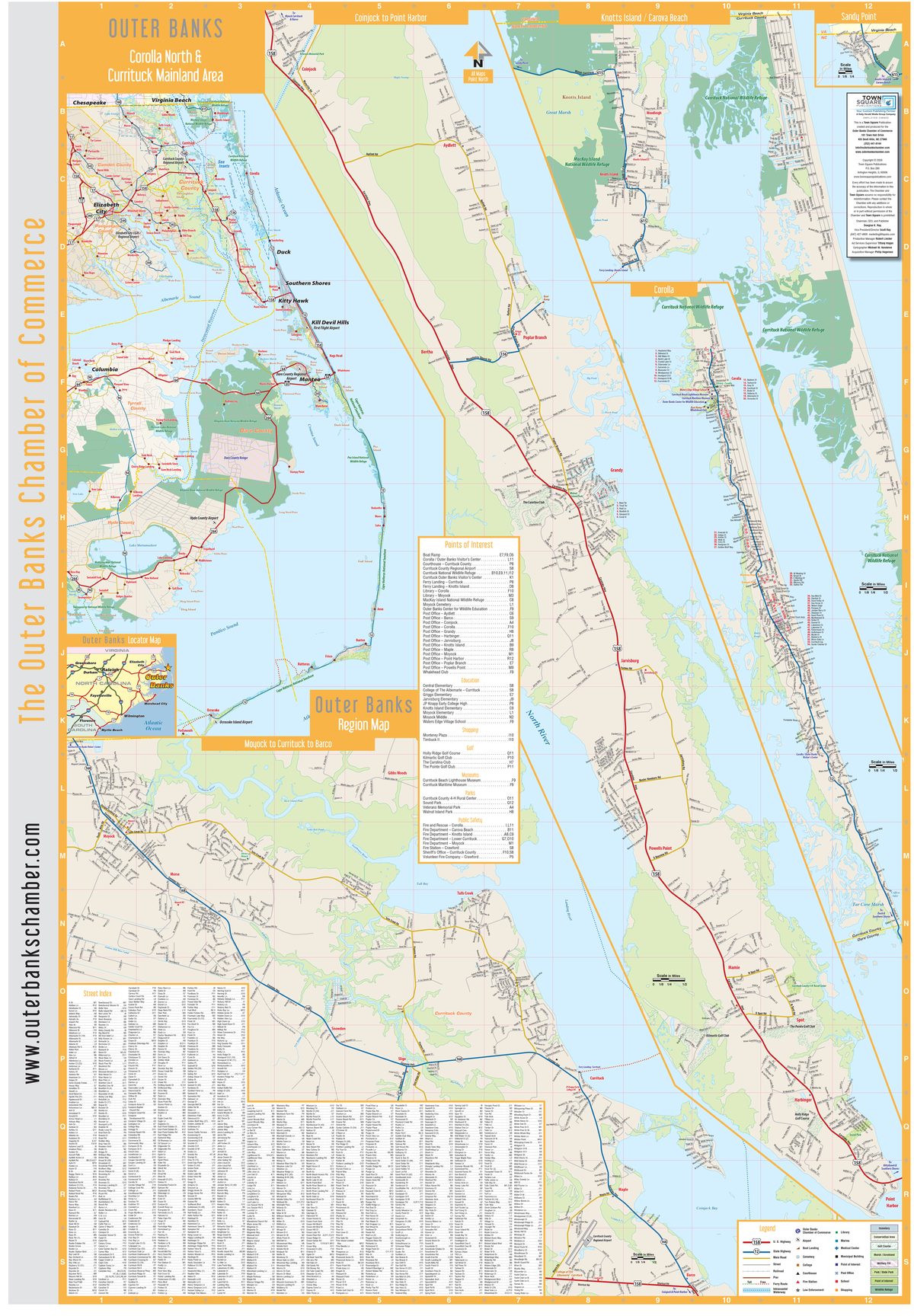
Corolla North & Currituck Mainland
Carova, Corolla, Knotts Island and the Currituck mainland, Moyock to Point Harbor
Download PDF (7 MB)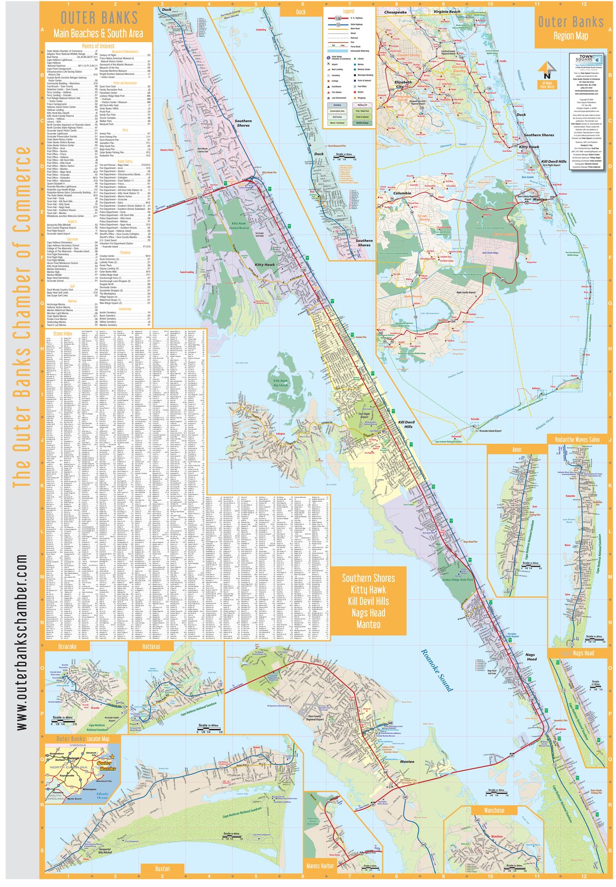
Main Beaches & South Area
Duck to Nags Head, Roanoke Island, Hatteras Island and Ocracoke
Download PDF (8 MB)Tip: on a phone, open the PDF and pinch to zoom. Page 2 of each map lists the local businesses featured on it.
 North Carolina's Outer Banks are a string of barrier islands that begin at the Virginia border and go south for 120 miles to Ocracoke Island. Tourism is the number one industry of the Outer Banks with more than 5 million visitors each year.
Dare County covers an area of 800 square miles, of which 391 square miles is land. The elevation of Dare County is 11.3 feet. Located in the northeast section of the state, it is bounded by the Atlantic Ocean; Pamlico, Croatan, and Albemarle Sounds; and Hyde and Tyrrell Counties.
Currituck County is the northeastern-most county in the U.S. state of North Carolina. The county was formed in 1668 as a precinct of Albemarle County and later gained county status in 1739. The name is traditionally said to be an Indian word for wild geese, Coratank.
Ocracoke Island is the southernmost village within the Cape Hatteras National Seashore. The entire island is owned by the National Park Service, except for the village. It is the most remote inhabited island of the Outer Banks and can be reached by ferry from Hatteras Village, Swan Quarter or Cedar Island. Ocracoke Island is 13 miles long, 2 miles wide and located in Hyde County.


